Boyer proposes changes to San Marco Overlay amendment
Posted on August 5, 2016 By Editor Articles, Neighborhood News, Top Stories

City Council President Lori Boyer no sooner filed an ordinance amending the San Marco Zoning Overlay when several in the development community suggested she consider amending her proposed amendment, particularly where it concerns certain areas of commercial development in San Marco.
On May 18, Boyer had filed Ordinance 2016-367, which would prevent developers from applying for Planned Unit Development (PUD) rezoning as a way of weakening the Overlay’s development standards. The ordinance stated “no PUD rezoning shall be allowed that waives or alters any development standard established by the Overlay.”
The ordinance was scheduled to be discussed at the Land Use and Zoning Committee meeting July 26 but was deferred when several would-be developers persuaded Boyer to consider “relaxing” the height restrictions in certain commercial areas within the Overlay in San Marco. The amendment to the bill is scheduled to be addressed Tuesday, Aug. 2 by the Land Use and Zoning Committee.
Before it makes its way to City Hall, Boyer said she wanted to discuss her changes to the proposed ordinance with the crowd at a town meeting sponsored by the San Marco Preservation Society July 28. The meeting was held at Southside Baptist Church. At press time, the amendment had not yet been drafted, she said.
“I’m trying to, as they say in the legislative process, make sausage,” she continued. “My goal is to maintain the integrity of the Overlay – to maintain what we were trying to ensure, which was to protect the historic character of the area and the feel of the community – but to also provide some flexibility for those commercially zoned properties in the event there are proposals for redevelopment that we might think are valid,” Boyer said.
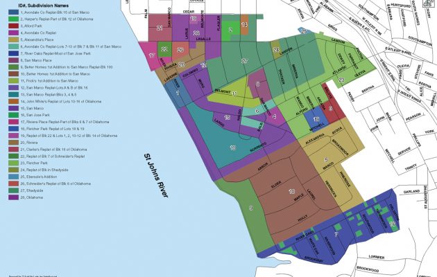
The boundaries of the San Marco Overlay are Cedar Street in the north, Craig Creek in the south, the St. Johns River in the West and the railroad tracks and Kings Street in the east. The Overlay and its boundaries differ from San Marco Preservation’s neighborhood action plan, San Marco by Design, which seeks to provide guidance for neighborhood continuity to developers and the city’s Planning and Development Department in an effort to provide walkability and preserve the character of San Marco’s neighborhoods.
Boyer said the city adopted the San Marco Overlay in 2004 when there was a concern about several development proposals coming before the city’s Planning Department causing a push to establish a historic overlay in San Marco similar to the one in Riverside and Avondale. At that time, it was decided to go with a less restrictive overlay than one that would require property owners to get certificates of appropriateness when they want to make changes to their property.
Most buildings in the San Marco Overlay are required to be no higher than 35 feet, which is consistent with the original plats as well as historic building restrictions and setback lines. For areas where there were no historic setback lines in the plat, a survey of San Marco was done and the Overlay was drawn up to reflect the houses and businesses that were actually on the ground at the time of the survey, she said. “They took how they were set back and those standards were adopted for the area,” she said. “It addressed the historical height limits for those areas, which was 35 feet.”
However, within the existing Overlay is a provision for administrative deviations, which, if granted, allow developers to relax the existing requirements as long as they meet the other criteria of the Overlay, she said.
By amending her proposed bill, Boyer plans to loosen the height requirements from 35 feet to allow a baseline of 50 feet for properties on the north side of Atlantic Boulevard from Hendricks Avenue to the railroad tracks, which is considered to be a transportation corridor. Also included will be a block of properties on the south side of Atlantic that back up to Olevia Street near the new Overland Expressway exit ramps, Daily’s, and Southside Assembly of God Church, where a developer might want to construct taller buildings.
All the areas are currently zoned CCG-1 and CCG-2, zoning which allows 50-foot buildings in areas not superseded by the Overlay district. Two buildings – East San Marco and the Demetree Office Building, which were already approved – are higher than 35 feet, with a portion of East San Marco planned to tower higher than 50 feet. None of the buildings in this area are adjacent to residential neighborhoods
The area east of the railroad tracks on the north side of Atlantic Boulevard would be left at 35 feet due to its proximity to historic World War I housing and several Klutho homes.
In Parcel 4, the area on Hendricks where the Bank of America and Southern Bell-AT&T building lie, as well as some commercial frontage on either side along Hendricks Avenue near Southside Baptist Church, PUDs would be allowed which waive the height requirement, but developers would submit their applications with the understanding they would be judged by the criteria of the Overlay and evaluated on how they impact and transition to single-family houses which rest behind the commercial corridor. “We want to preserve those residential neighborhoods,” she said.
Boyer said she will make no such recommendation for San Marco Square because that is an area where in the past there was a desire by the community to have the storefront buildings designated historic. “We have not done that, and I am not suggesting that we do that, but I do think it is appropriate that we keep these same criteria that we had before. Storefronts on the street and heights so we don’t have any one building that’s out of character with the rest,” she said.
By Marcia Hodgson
Resident Community News


 (No Ratings Yet)


