

Klutho’s dream of urban connectivity gains momentum

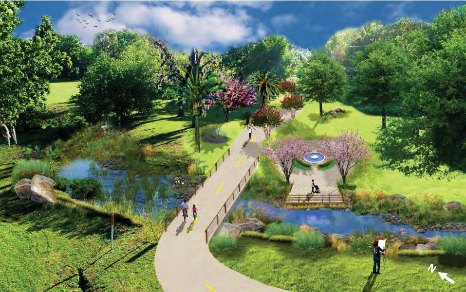
A rendering of a restored McCoys Creek along McCoys Creek Boulevard gives future users a glimpse of what an urban nature trail could look like.
Although it’s been long known as the Emerald Necklace, a map of preliminary alignments connecting 14 neighborhoods in the urban core suggests a spider web.
Envisioned more than a century ago by architect Henry J. Klutho to be a series of connecting parks and greenways, the Emerald Necklace will eventually include a hiking and biking trail along several waterways, but the project could take 10 years to build and significant funding.
About 300 residents filled the auditorium at Florida State College—Jacksonville’s downtown campus July 24 to get a preview of what Groundwork Jacksonville has in mind for completing Klutho’s dream. The nonprofit’s goal includes restoring creeks, building trails, creating parks and installing public art. It could also include a name change if a “necklace” is no longer an accurate description.
The 24-mile trail begins at and includes the S-Line (a 4.8-mile rails-to-trails multi-use path) in the northeast section of the urban core, stretches west to the KIPP Middle School, wanders down to Memorial Park in Riverside, then crosses the river to San Marco. The project, at an average cost of $2 million per mile, will have significant benefits for the community, said Kay Ehas, Groundwork Jacksonville CEO, and Riverside resident, in an interview prior to the public meeting.
According to research Ehas has done, the improvements will raise property values and spur economic development while providing a safe, aesthetic environment for exercise.
During the July 24 presentation, Ehas said trails retain youth and local talent, while attracting new businesses and increasing revenue at existing ones. Trails also support active transportation, promoting less dependency on cars and expansion of roadways.
“We’re designing this for the 60 percent of people who are interested but concerned about riding bicycles on the road,” said Ehas, stating they are trying to identify low-volume, low-speed roads for the neighborhood connections to the trail.
The master plan is looking at a variety of trail types, from greenway trails completely separated from vehicular traffic, to side paths separating pedestrians and cyclists from traffic by landscape buffers, to transforming under-utilized alleys into community shared-used space, among other types.
Ehas believes a combination of public and private dollars, including grants, may be the way to get the trail built. An implementation plan, when finalized, will identify the cost and prioritization of each trail segment.
The $88,200 cost for the trail master plan, developed by PATH Foundation and KAIZEN Collaborative, is being privately underwritten by a $50,000 donation from JTC Running (JTC), as well as through grants from Local Initiatives Support Corporation (LISC) and the Giving Forward Community Endowment Fund at The Community Foundation for Northeast Florida.
PATH Foundation has built over 275 miles of greenway trails, including the Atlanta BeltLine, and KAIZEN has master-planned 875 miles of multi-use trails with more than 30 communities.
To generate excitement about and support for the ambitious project, Groundwork is trying to first develop a “model mile,” which will show what can be done and how it will benefit the community. They are currently looking at three options.
One option, from Riverside Park to Central Riverside Elementary School, will cost $1.5 million to develop 1.3 miles of walkable, bikeable trail. Another option connects Hogan Street from an area slightly north of FSCJ down to The Landing, a cost of $2 million for 0.9 miles, while the last option at the S-Line on W. Beaver Street and works its way to McCoys Creek past the convention center. Those 1.4 miles would cost $3.6 million.
Next steps after collecting public feedback include finalizing a Master Trail Plan report to submit to City Council for adoption, and then designing building the “model mile” trail segment would begin.
McCoys Creek restoration
As part of the Jacksonville Master Trail plan, Groundwork Jacksonville is partnering with the City to develop the creek restoration plan portion of Mayor Lenny Curry’s McCoys Creek project.
Mayor Curry’s proposed budget for 2018-2019 includes $13 million to begin restoration of 2.8 miles of McCoys Creek, which has been estimated to cost nearly $60 million over four years. The plan would include raising or removing bridges, restoring natural channels, creating greenways, and building kayak launches.
Groundwork is working with Wood Environment & Infrastructure Solutions, Inc., a Florida creek expert, on a natural channel design to potentially redirect the flood-prone McCoys Creek by removing manmade barricades.
“Natural channel design becomes stronger over time,” said Ehas, who has support from the St. Johns River Water Management District for the concept. “Planting the right trees makes it more self-sustaining over time, and it will be able to deal with more storm water than it does today.”
The McCoys Creek Restoration evaluation and design plan will cost $326,242 and is coming from a variety of sources, including a request by the City’s Environmental Protection Board for City Council to approve $84,600.
By Kate A. Hallock
Resident Community News
 (No Ratings Yet)

